National Geographic Traveller | January 2026
Void of discovery
Forget the touristic trappings of the Grand Canyon, says Duncan Craig. With backcountry camping, river swims and endless solitude, the multi-day Escalante hiking route offers an altogether deeper insight
One-armed, lavishly bearded and as tough as bedrock, John Wesley Powell was the leader of the first river passage through the Grand Canyon. The geologist and explorer wrote extensively and eloquently about his expedition in 1869, concluding: “You cannot see the Grand Canyon in one view, as if it were a changeless spectacle from which a curtain might be lifted. To see it, you have to toil from month to month through its labyrinths.”
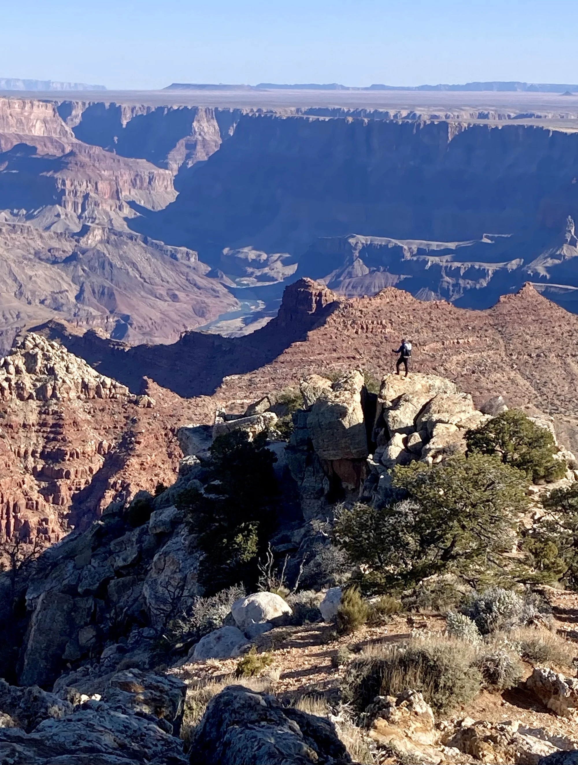
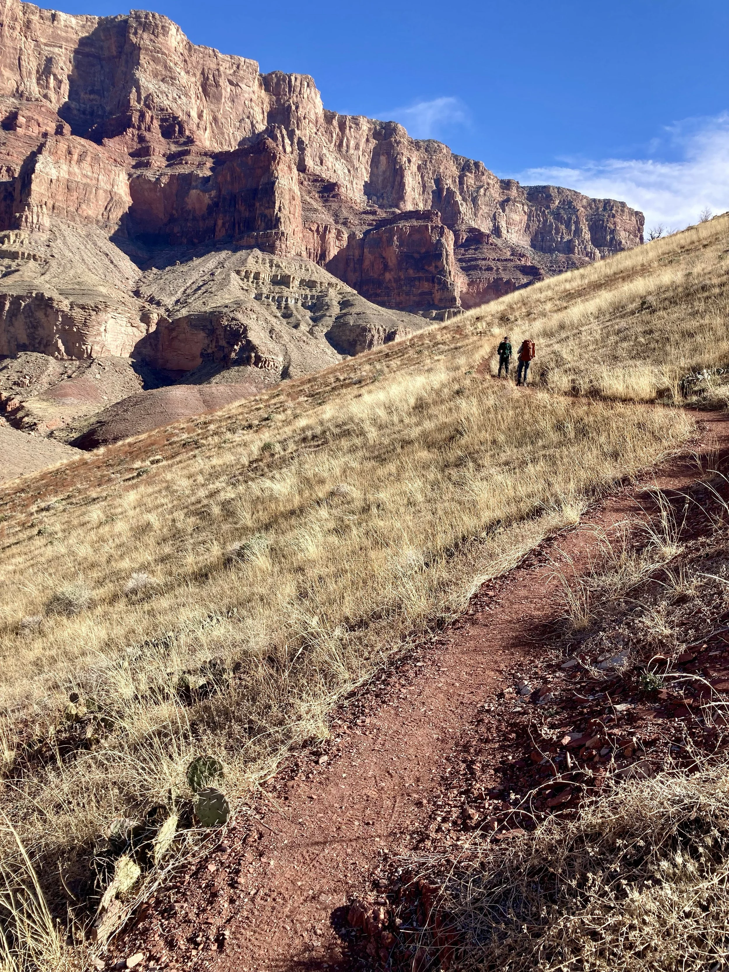
It’s in this spirit – if not quite timeframe – that I arrive in Arizona’s foremost national park. I’m hiking the Escalante Route: a four-day circuit that snakes down from the South Rim, the entry point to the canyon for the vast majority of visitors, all the way to the banks of the mighty Colorado. Ten dramatic miles of river frontage are traced before the route joins up with the fabled Grandview Trail for the ascent back up to rim level. It’s a 35-mile backcountry beauty, tackled by a tiny fraction of the millions of visitors who converge on the Grand Canyon each year, and I can’t wait to get started.
First, however, I have a small problem.
“Slightly awkward question,” I say, smiling at the national park official sheepishly. “But where exactly is the canyon?”
She looks at me sympathetically – clearly I’m not the first visitor to misplace one of the largest landforms on Earth.
The problem is one of sight lines. The Colorado Plateau - elevated by tectonic forces long before the Colorado River and its attendant tributaries reached for their chisels - is unerringly flat and coated with pine and juniper forest. Which means a chasm measuring nearly 280 miles long, 10 miles across and a mile deep can be concealed, it transpires, with little more foliage than you’d need to mask an unsightly shed.
The pay-off, of course, is the big reveal.
One thinks of a canyon as an absence, a tranche of negative space. But this is very much a work in progress, with the residual rock sculpted into a maze as sprawling and intricate as a metropolis. Pinnacles and spires soar skywards. Muscular, sheer-walled escarpments fall away to dusk-shrouded gorges. Isolated, flat-topped buttes fan out at their base like extravagant ballgowns.
‘Unfathomable’ is an overused adjective these days but, to the Spanish conquistadors who arrived at the South Rim in 1540 – the first Europeans to see the Grand Canyon – it was apt. Humiliatingly so.
Guided by members of the native American Hopi tribe, García López de Cárdenas and his men were taken to the chasm edge, where they attempted to process what they were surveying. The river that they could just make out on the canyon floor must be around 6ft across, they estimated. The boulders lining its path? Likely no bigger than a man. “Nip down and take a look would you, chaps?” was the gist of the order Cárdenas gave to his men, and for three fruitless days they tried – scrambling frustratedly around the canyon’s vertiginous walls and barely penetrating its craggy immensity.
Eventually they returned, exhausted. The river, they reported, was in fact wider than Iberia’s Tagus, and those man-sized boulders “higher than the great tower of Seville”. The Grand Canyon would remain unbreached by Europeans for a further two centuries.
It’s from close to the spot at which Cárdenas and his men made their wildly erroneous estimations that my hike begins. Here, some 25 miles east of the busy trails and viewpoints accessed from the rim-edge Grand Canyon Village, and more than 100 miles from the glass-bottomed Skywalk bridge, it’s eerily quiet. Far below, I can see the dusty-blue sliver of the Colorado approach from the north and swing theatrically west.